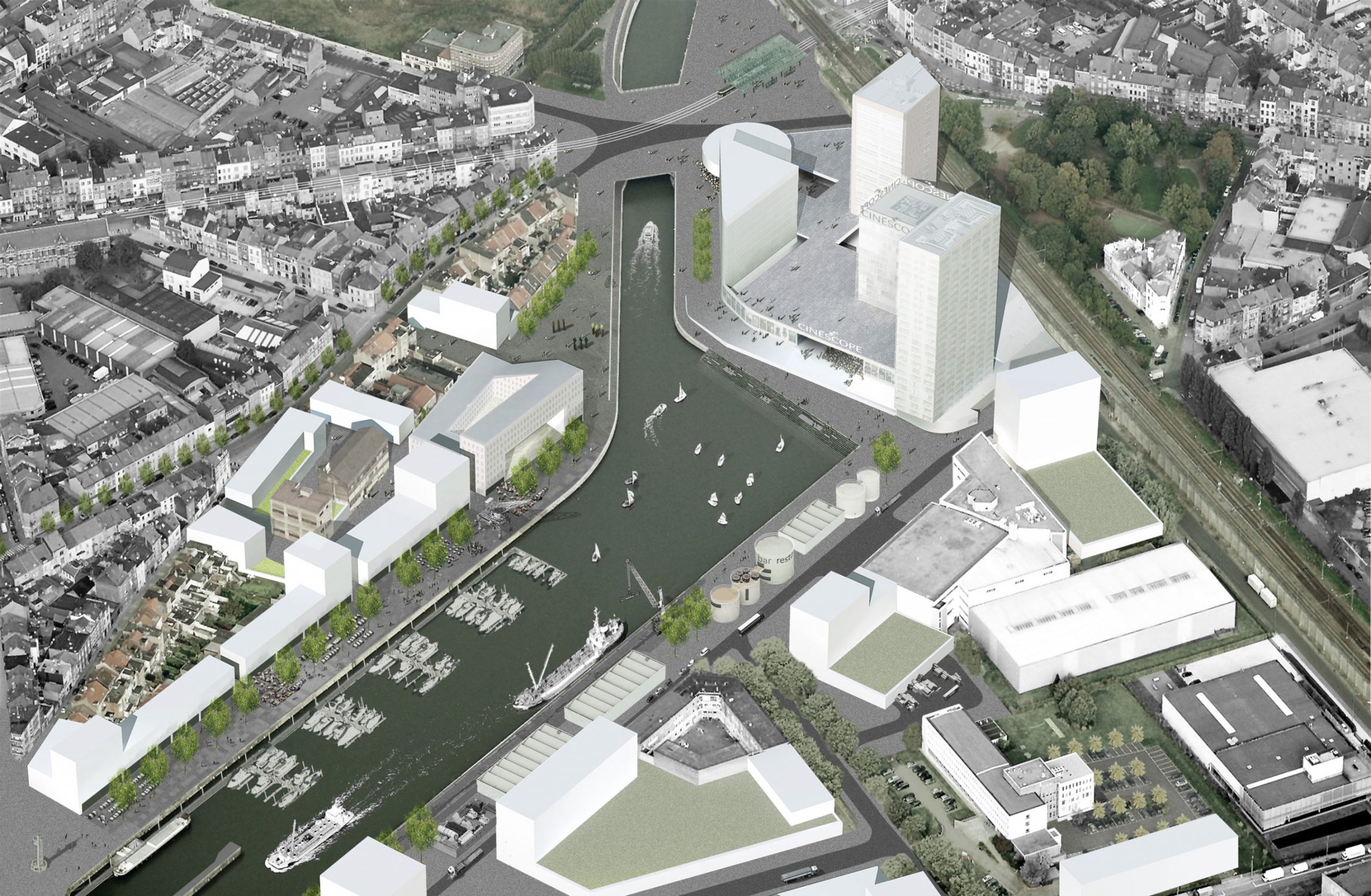
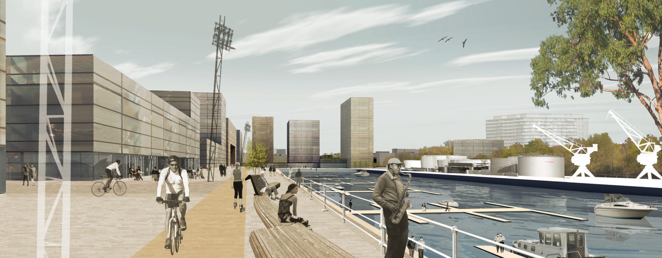
The Biestebroekdok is an underexploited part of the canal area located in the south of the Brussels-Capital Region, surrounded by several neighbourhoods characterized by a high level of densification. By analogy with other urban transformation projects in the canal area, the development program requires a new definition, a new relationship and a common spatial consistency: space for the harbour logistics, the economic activities, housing and public equipment.
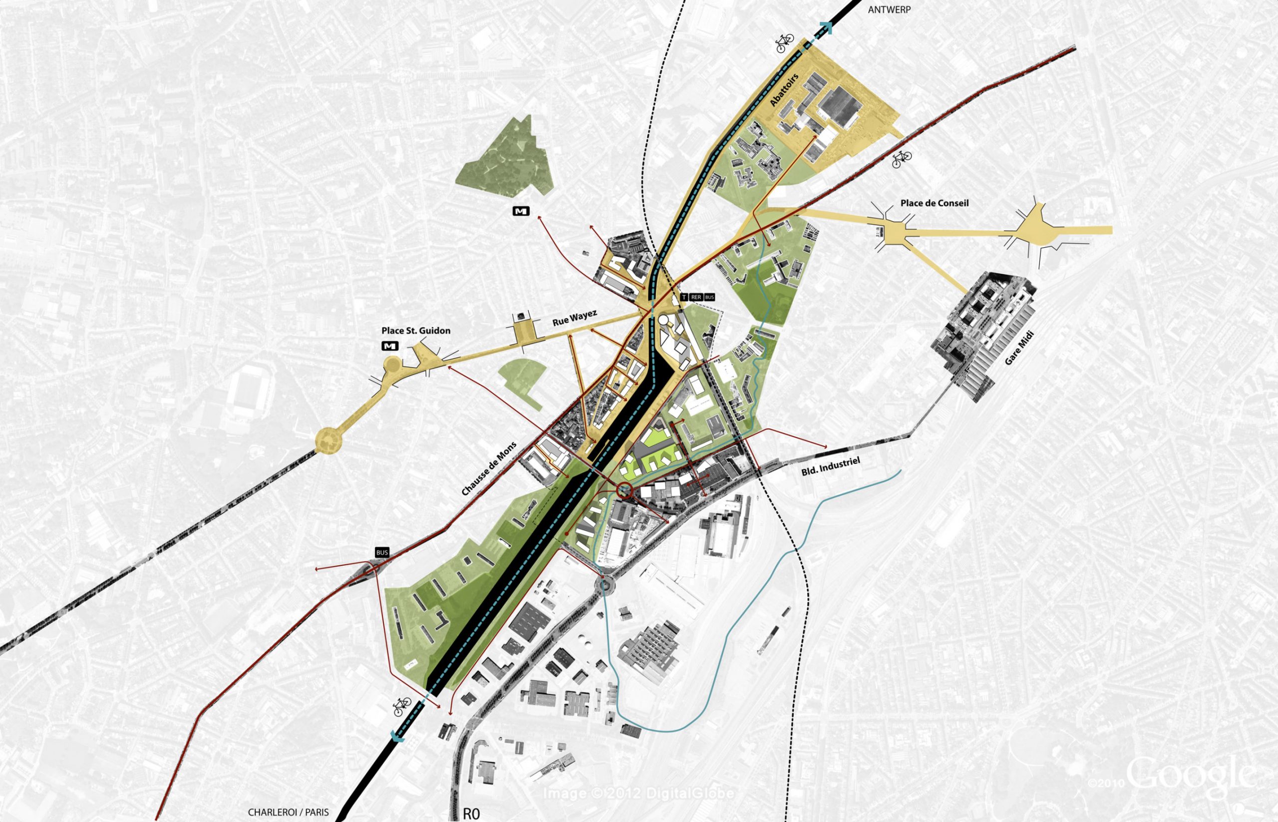
To define a future vision for this strategic part the Brussels Region and to translate it into a land use plan, the city of Anderlecht, in consultation with the Brussels-Capital Region, has charged the temporary union BUUR-Aries Consultant to elaborate a Special Land Use Plan. To develop a vision that is supported by both the regional and local public authorities, BUUR has first drawn up a masterplan with guidelines for future developments. These guidelines have been based on an overall diagnosis of the urban space, the social economic reality, the mobility and the projects that have been set up in the surroundings. A public walk, a survey and thematic workshops have been organized during the diagnosis phase to inform all the involved key players.
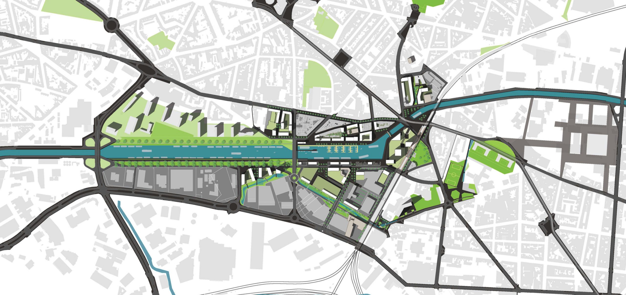
The masterplan defines six project lines: the banks of the canal; the ‘Bergensesteenweg’ and the connection to the left bank; the ‘Wayezstraat’ including a new commercial cluster; the intermodal REN junction, next to the bridge of Kuregem; the economic area on the right bank; the valley structure of the Zenne. Each project line has its own functional features, presents a particular approach with regard to traffic development and translates the plan into programs for buildings and public space. The contamination of certain parcels requires specific scenarios with regard to the development program and the densification of the right bank, depending on the financing modalities (whether private or public) that will be used for the soil and groundwater purification.
Subprojects have been set up for each individual project line after the completion of the masterplan.